60 mph storm cuts power to about 3,300 in Shiawassee County
A severe thunderstorm warning crossed the whole county Thursday afternoon with 60 mph gusts and penny-size hail, and Consumers Energy logged outages in at least 10 communities — 735 customers near Lennon, five separate breaks around Laingsburg.
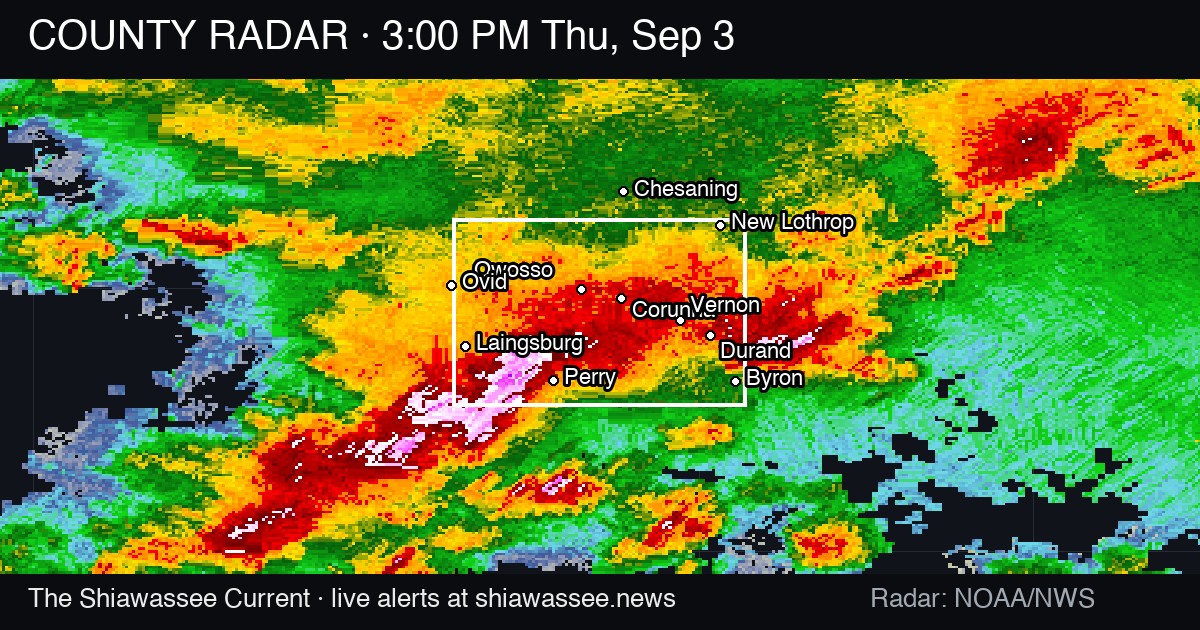
A line of severe thunderstorms crossed Shiawassee County Thursday afternoon with 60 mph wind gusts, and by the time it cleared, Consumers Energy's outage map showed roughly 3,300 customers in at least 10 county communities without power.
The largest single outage was near Lennon: 735 customers, cause listed as storm damage, with an estimated restoration time of 5:30 p.m. Near Perry, 399 customers went dark. Near Bancroft, 371. Near Corunna, 152. Near Elsie, 167, with a restoration estimate of 9:15 a.m. Smaller outages were posted near New Lothrop, where the map listed trees as the cause for about 45 customers, and near Morrice, where about 24 customers lost power to what the utility called an equipment issue. The map also showed outages near Durand and Owosso.
Laingsburg broke in more places than anywhere else in the county. The utility posted five separate storm-damage outages in the Laingsburg area — about 394 customers, 293, 117, 87 and 33 — totaling more than 900 customers across the south end of the county. Consumers Energy's map gives a cause and a customer count for each break but does not say why one area's circuits failed at so many points; the company has not published an explanation.
The National Weather Service in Detroit/Pontiac had a severe thunderstorm warning in effect for all of Shiawassee County from 2:11 p.m. until 3:15 p.m. Thursday. In its 2:21 p.m. update, forecasters said radar showed severe storms along a line from near Oakley to near St. Johns, moving southeast at 30 mph, carrying 60 mph gusts and penny-size hail. "Expect damage to roofs, siding, and trees," the warning said. It also told drivers not to cross flooded roads, saying torrential rain was falling and could cause flash flooding.
The weather service listed the towns in the storm's path by the minute: Henderson around 2:25 p.m., Owosso around 2:30, New Lothrop and Corunna around 2:35, Bancroft and Lennon around 2:50, Durand around 2:55, and Byron around 3:05. Juddville, Bennington, Shaftsburg, Carland and Vernon were also named.
The warning answers a question this desk left open Thursday. The Current reported that afternoon that the weather service had placed all of Shiawassee County under Severe Thunderstorm Watch 648 until 7 p.m., and that it was not yet clear whether any warnings would follow inside the watch window. One did, countywide, about 20 minutes after the watch was issued. It was the county's second round of storms that day — The Current also reported a special weather statement for 50 mph gusts and nickel-size hail tracking east from Laingsburg toward Perry, Corunna, Owosso, Durand and Byron before 11 a.m.
The outage records the desk logged carry restoration estimates ranging from overnight to Thursday evening, and they do not establish which circuits are back this morning. The weather service has not published a damage survey or a list of confirmed wind reports for the county, so there is no official account yet of what came down and where.
What happens next
The Current has asked Consumers Energy for the final customer count, restoration times and the cause of the multiple Laingsburg-area breaks, and has asked NWS Detroit/Pontiac for any confirmed wind or hail reports from Shiawassee County. We will update when either answers. If your power is still out, outages can be reported through Consumers Energy's outage center.
The Morning Current. Free, daily, by 6 AM.
Every council vote, police report, and school decision in Shiawassee County — before your first coffee.